
NavList:
A Community Devoted to the Preservation and Practice of Celestial Navigation and Other Methods of Traditional Wayfinding


From: Antoine Couëtte
Date: 2025 Jun 24, 07:41 -0700
Dale,
All the best if I have been able to help you.
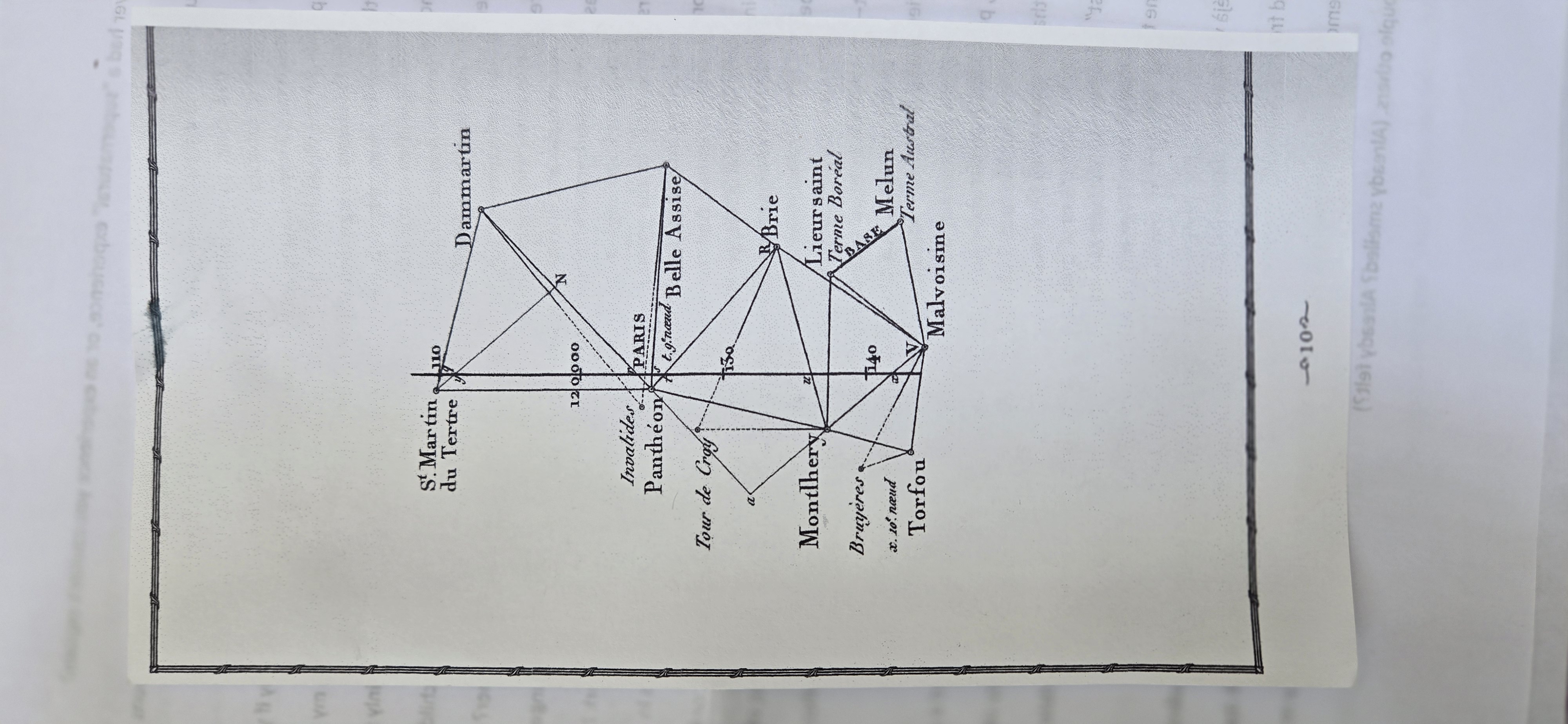
It turns out that, about one year ago, I happened to quickly study this same Paris Meridian Campaign by Delambre and Méchain, in order to help one our Grand'Daughters for her school duties. It was not difficult to solve her triangle problems pertaining to this same "Frame" surrounding Paris.
Nonetheless I had already decided then to look up a bit further at some later time in order to exactly guess-understand how they actually could measure successive portions of the Meridian : you exact request gave me this opportunity.
Thanks for it.
I think I have [found and] depicted some reasonable method here, and if somebody can shed additional light, that would be great.
Ground distances were derived from one "Base" length - here the "Melun - Lieusaint" line - with Lieusaint erroneously showing up as Lieursaint in this page your document, while it shows up correctly on other pages.
This reference Line - dubbed "BASE" on your document - had to be painstakingly measured with some ruler ... Much enjoyment indeed !
Unless proven to the contrary, it was probably the case that the entire Meridian length - spanning over some 10° of Latitude (Dunkerque to Perpignan) - depended on the accuracy of this very Melun-Lieusaint Base-line length determination.
What they also needed were accurate determinations of both Latitudes on both ends of the Meridian, as well as frequent North-South Azimuts checks in order to avoid "drifting" East or West. Most probably there were using the Sun (maybe Polaris too ???) since by this time the Sun Ephemeris - and Polaris Ephemeris too - from La Connoissance des Tems were already remarkably accurate by a few arcseconds as can be verified to-day with modern computation tools.
That's about alI I can figure out - and I keep guessing hopefully without too many errors so far - since I am not a land-surveyor.
All in all, achieving an accuracy of 0.2 milli-meter over 1 meter was not an easy task then and it certainly came out as some remarkable achievement for the time.
Kermit


