NavList:
A Community Devoted to the Preservation and Practice of Celestial Navigation and Other Methods of Traditional Wayfinding
From: Brendan Kinch
Date: 2014 Aug 13, 21:18 +0200
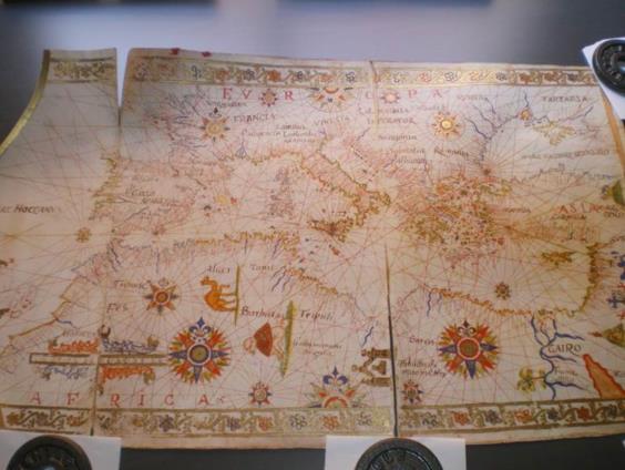
This is what a Portolan Chart looked like:-
Not an original I am afraid……just a certified copy (exact - right down to the splits).
Unsure if the photo gets posted……3 photos available here at this Dropbox link: https://www.dropbox.com/sh/w1kxqkva5idwx1j/AACwx10OnNO3tVNEdG3beF9-a
Kinch.
From: NavList@fer3.com [mailto:NavList@fer3.com] On Behalf Of David Fleming
Sent: 13 August 2014 20:06
To: BrenKinch@gmail.com
Subject: [NavList] Re: Old charts and traditional navigation methods
The compass roses on the 18th century charts are a horistorical carry over from the Portolan Charts that preceeded Mercator Charts. In Portolan charts chart position was based on dead reckoning ie estimates of distance traveled in the directions of the points of the compass.
Dave


