NavList:
A Community Devoted to the Preservation and Practice of Celestial Navigation and Other Methods of Traditional Wayfinding
Radar Plotting Sheet for Polaris
From: Greg Rudzinski
Date: 2009 Oct 18, 16:45 -0700
From: Greg Rudzinski
Date: 2009 Oct 18, 16:45 -0700
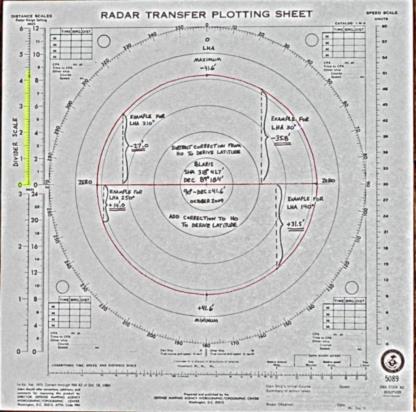
A radar plotting sheet can be used for correcting a Polaris HO to get
Latitude. 90° minus Polaris declination will give the diameter of the circle
in minutes of arc. The attached example is 90° - 89° 18.4' for a 41.6'
plotting sheet circle diameter. Intersect the circle with the LHA of Polaris
then measure to the baseline with dividers. The scale at the upper left will
provide the correction to better than a minute of arc.


--~--~---------~--~----~------------~-------~--~----~
NavList message boards: www.fer3.com/arc
Or post by email to: NavList@fer3.com
To , email NavList+@fer3.com
-~----------~----~----~----~------~----~------~--~---


